(239) 301-8913 Departing Marco Island & Naples, FL
⚓ USCG Licensed & Insured 4.9★ from 2,000+ guest reviews — read them on Google & Tripadvisor
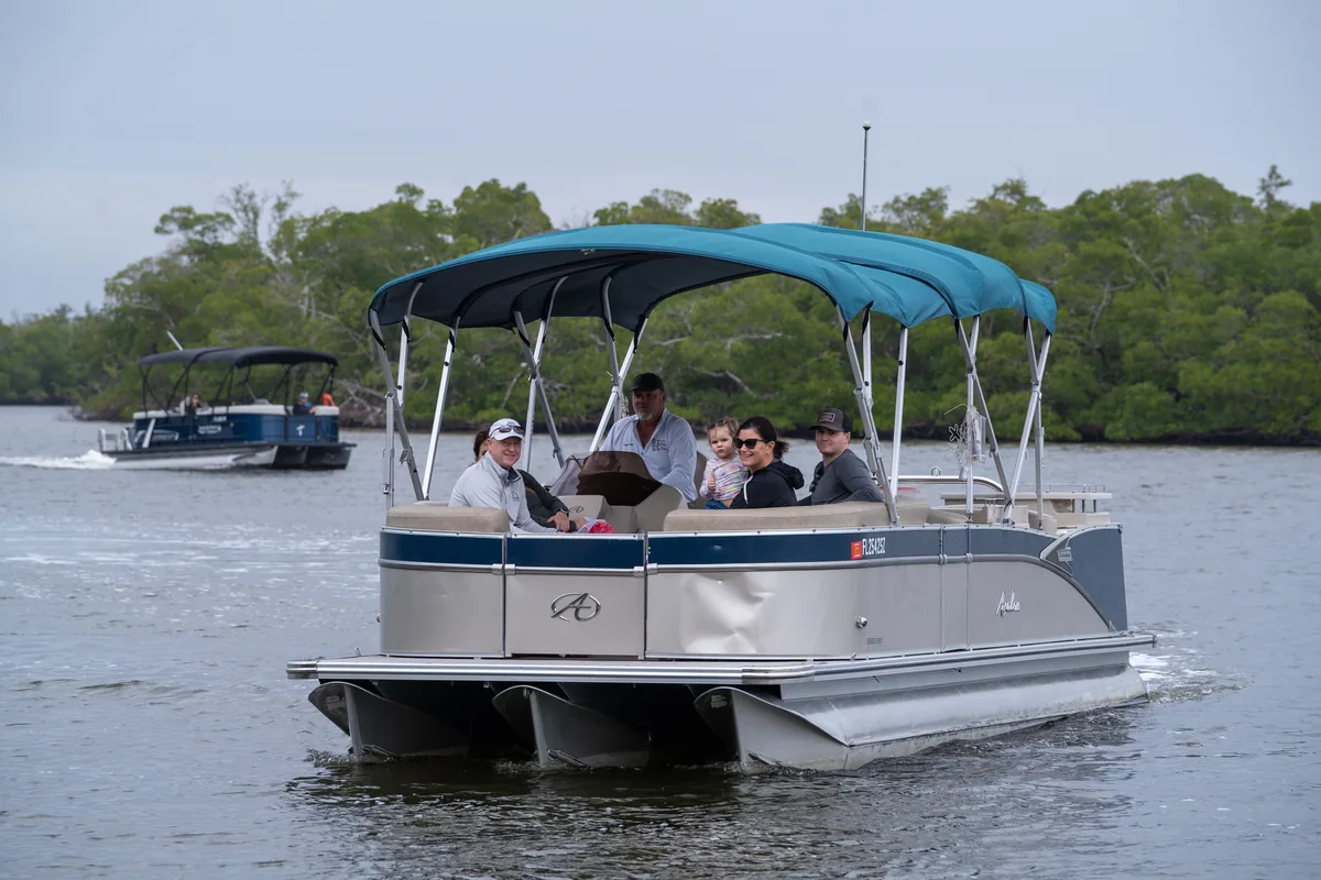
A family aboard the teal-canopied Sand Dollar Avalon pontoon running a narrow mangrove channel in the Ten Thousand Islands, with a second pontoon following behind

Day Trips

Boat Tour Day Trips from Miami to Marco Island & Naples

The reason to point a car west out of Miami is the water at the far end of the road — a roadless maze of mangrove keys and unbridged shell beaches the Atlantic side has no version of. The good part is that you get to choose your road; the honest part is that our Goodland dock sits 2 hr 25 – 3 hr away on Alligator Alley, or 3 hr 05 – 3 hr 35 if you take the Tamiami Trail.

  • San Marco Marina, Goodland
  • 2 hr 25 – 3 hr to Goodland via I-75
  • All ages welcome
  • USCG Master Captains
Drive to Goodland2 hr 25 – 3 hr on I-75; 3 hr 05 – 3 hr 35 on US-41
Departure marinaSan Marco Marina, 604 E Palm Ave, Goodland, FL 34140
Waterthe Ten Thousand Islands — unbridged keys, tidal passes, shell beaches
You may seedolphins, wading birds, white pelicans — wild animals, never promised

The Road West

Two ways across the state, and why the choice matters

Miami has an ocean at the end of its own streets, so nobody drives west for a beach. What sits at the far end of this road is a different animal: the Ten Thousand Islands, a roadless spread of mangrove keys, tidal creeks and unraked shell beaches where the Gulf runs into the Everglades. No bridge reaches any of it, which is the whole argument — the day-trips hub lays out what is back there and which trips reach it. This page is about the part in between. From Miami, and really only from Miami, the road across is a genuine choice, and it can be half the reason you go.

Two paved roads cross the bottom of the state, and they are not the same trip. Alligator Alley — the I-75 stretch — is four lanes, tolled and fenced the whole way; you cover ground fast and remember none of it. The Tamiami Trail, US-41, is the old two-lane road along the northern edge of the Everglades, slower for reasons you will be glad of. The arithmetic is the part to read before you book. To our Naples Bay dock: 1 hr 50 – 2 hr 20 on the Alley, or 2 hr 30 – 3 hr on the Trail. To Goodland: 2 hr 25 – 3 hr on the Alley, or 3 hr 05 – 3 hr 35 on the Trail.

Those two docks are not interchangeable, and this is the part people get wrong. Naples Bay Resort & Marina is downtown at 1500 5th Avenue South. San Marco Marina is at 604 E Palm Ave in Goodland, a working fishing village on the far southeast tip of Marco Island — another thirty to forty minutes beyond Naples. Shelling and the island landings both leave from Goodland, so if shells are the point, the Goodland figure is the only one that matters. A morning departure keeps this an honest day trip. A sunset cruise sends you back across the state in the dark, and a night nearby is the better call; where to stay is sorted by dock.

  • Two roads west: I-75 for speed, US-41 for the Everglades
  • Goodland sits 30–40 minutes beyond Naples — plan for it
  • Shelling and island landings depart from Goodland
  • A morning boat keeps it a day trip; sunset argues for a bed
Check Availability

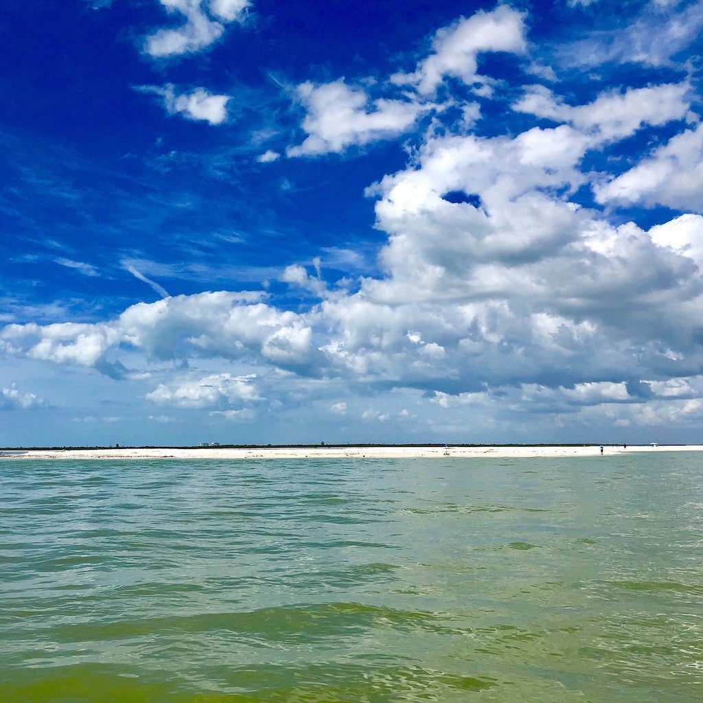
A wide view of shallow green flats and low undeveloped mangrove islands in the Ten Thousand Islands off Marco Island, Florida
Roughly three hours west of Miami, and only a boat gets you in

Pick Your Road

Miami to the dock, one decision at a time

The two routes, the call between them, and the last leg nobody warns you about.

01

The fork: two roads, one peninsula

Miami sits on the Atlantic side of Florida and every reason for this trip sits on the Gulf side, with the Everglades stacked in between. There are exactly two paved ways across, and they leave from different corners of the metro: I-75 picks up on the northwest side and swings west as Alligator Alley, while US-41, the Tamiami Trail, heads due west out of the city as an ordinary road that simply keeps going. Between them is sawgrass, cypress, water and tribal land — no shortcut, no third option, no clever back way a map app is hiding from you. The two do not meet again until Collier County. Make the choice at the kitchen table rather than at the on-ramp, because it moves your alarm clock by the better part of an hour.

02

Alligator Alley (I-75): the fast one

Four lanes, divided, interstate speed, and a tall wildlife fence running the length of both shoulders with underpasses cut beneath the roadbed so animals can get across without meeting a bumper. That fence is why the Alley shows you so little: a canal on one side, sawgrass past it, and a green blur at highway speed. It is a toll road, so settle how you are paying before the ramp — rates change and we are not going to quote you one. Treat the middle as empty country: top off the fuel and use a restroom in town, and do not assume a strong phone signal all the way across. Figure 1 hr 50 – 2 hr 20 to our Naples dock and 2 hr 25 – 3 hr to Goodland. You leave it at Collier Boulevard.

03

The Tamiami Trail (US-41): the one that counts as sightseeing

Two lanes for most of its length, running along the northern boundary of Everglades National Park and straight through Big Cypress National Preserve. A canal follows the road for miles, alligators lie out on the bank in plain view from the shoulder, and the sawgrass runs to the horizon on the far side. Wood storks, herons, anhingas drying their wings on a guardrail. The Big Cypress visitor center and the Shark Valley park entrance both sit on this road, and airboat country starts about where the city stops. It costs you roughly forty minutes over the Alley before you stop for a single thing: 2 hr 30 – 3 hr to Naples, 3 hr 05 – 3 hr 35 to Goodland. It also carries on past the turn for Everglades City and Chokoloskee, the southern doorway into the same island chain.

04

Making the call: Trail out, Alley home

Here is how we would run it. Take the Trail westbound, in daylight, and budget the Trail number instead of the Alley one — that is the whole trick, and skipping it is how people miss boats. Come back on the Alley, because two unlit lanes with wildlife on the shoulder is a poor end to a long day on the water. Run it the other way round and you spend your scenic hour looking at your own headlights. The version that falls apart is an early shelling departure: the Trail, plus a Goodland dock, plus a morning boat means rolling out of Miami before first light. If that is a stretch, take the Alley both directions, or book a later boat and give the Trail the daylight it deserves.

05

The last leg: Collier Boulevard, and the miles past Naples

Both roads end up in the same place. Whichever one you took, the closing stretch is Collier Boulevard heading south — off I-75 at the Collier Boulevard exit, or off the Trail at the big junction in East Naples. That junction is the one spot where the slow road claws time back: with Goodland as your dock, the Trail hands you the turn without routing you through downtown Naples at all. From there it is south over the bridge onto Marco Island, east on San Marco Road, and out the spur into Goodland. Call that final piece thirty to forty minutes on its own, and know that it is the piece most drive estimates quietly leave off. If your trip departs from Naples Bay instead, you are finished twenty-odd miles earlier, downtown at 1500 5th Avenue South.

06

The dock: San Marco Marina, 604 E Palm Ave, Goodland

Goodland is a small working fishing village on the southeast corner of Marco Island — low houses, crab traps stacked in yards, a handful of streets and a great deal of water. It is not a resort strip and it does not pretend to be one. Put the marina address into your map app rather than the town name, and plan to be standing in the lot fifteen or twenty minutes ahead of departure. The boat pushes off on the schedule the tide handed us, and on a shelling run that schedule is built around low water rather than around anyone’s alarm clock — which is exactly why the booking comes first and the itinerary second. Restrooms are right there. If the road is going badly, call (239) 301-8913 instead of guessing.

Who It Suits

Made for the Miami driver who…

Four versions of this trip, and the road that fits each one.

Wants the Everglades on the way

Take the Trail out in daylight — sawgrass, gators on the canal bank and Big Cypress, all before you board.

Is driving for shells

Book the Goodland departure the tide gives you, then set the alarm backwards from it.

Has the whole family in one car

A private charter suits a carload that just crossed a state together and would rather not share a rail.

Came for the sunset

Lovely on the water, long in the car afterward. Sleep near the dock and drive back in daylight.

The Far End

What is out there once the driving stops

Unbridged island beaches, mangrove shoreline birds, and the reason somebody in Miami set an alarm.

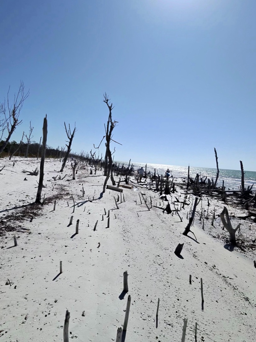
A wild, undeveloped barrier-island beach and shallow sandbar in the Ten Thousand Islands near Marco Island, Florida
No causeway, no rake, no beach bar — just tideline
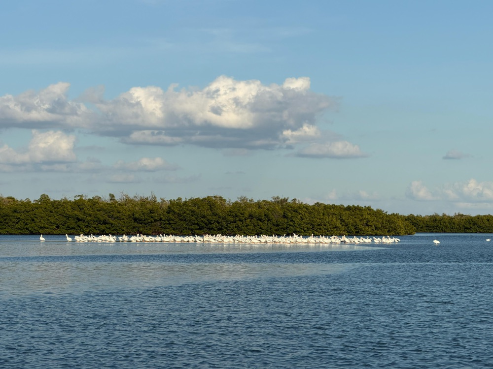
A long raft of white pelicans resting along a green mangrove shoreline in the Ten Thousand Islands, Florida
White pelicans strung out along a mangrove shore
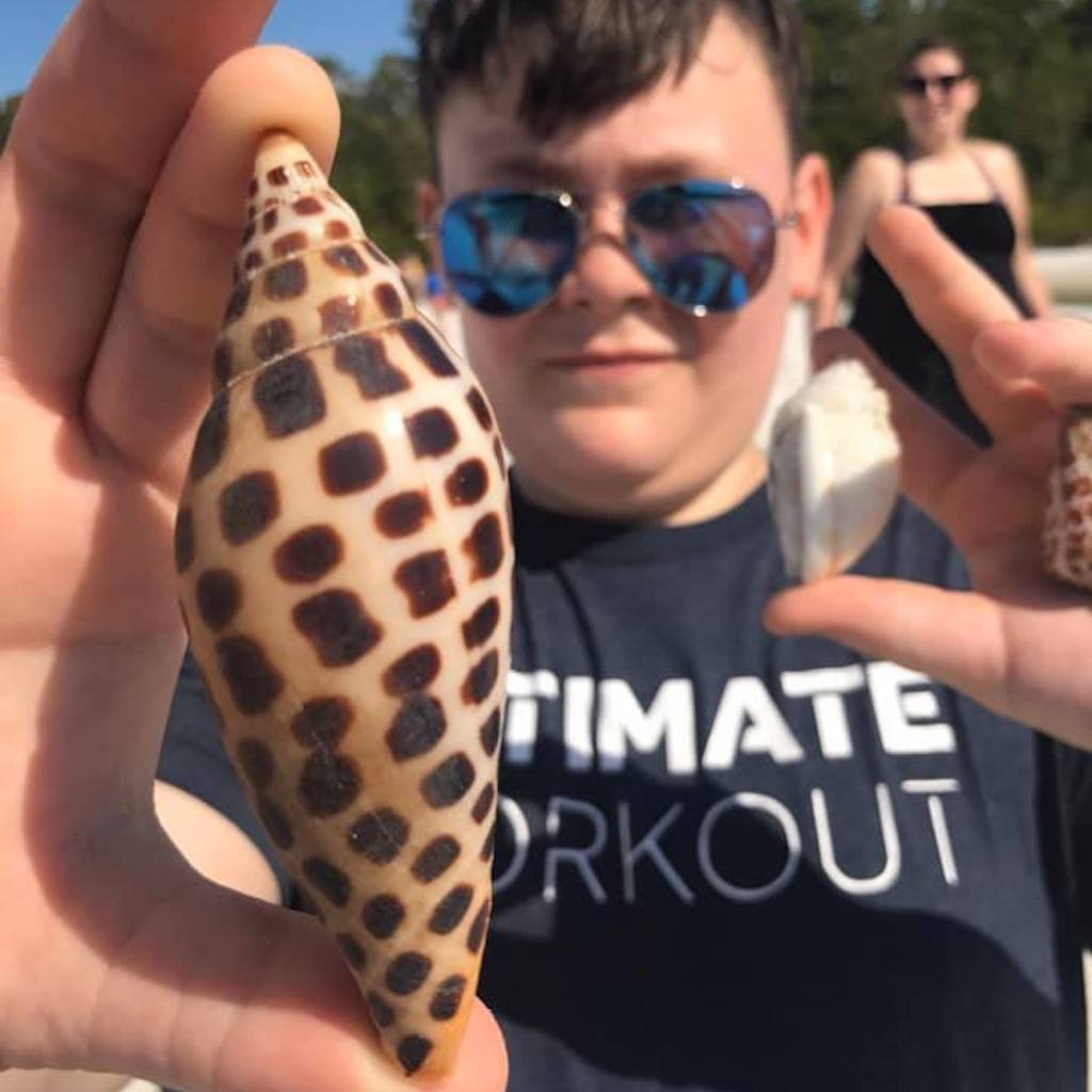
A young guest on a Sand Dollar tour holding up a large spotted shell found on a Ten Thousand Islands beach
The kind of find that repays a two-lane morning

Good to Know

Driving over from Miami, answered straight

Routes, real ranges, the difference between our two docks, and when to stay the night.

How long is the drive from Miami to your docks?

It depends on the road and the dock. Alligator Alley, the I-75 route, runs about 1 hr 50 – 2 hr 20 to Naples Bay Resort & Marina and about 2 hr 25 – 3 hr to San Marco Marina in Goodland. The Tamiami Trail, US-41, adds roughly forty minutes on top: about 2 hr 30 – 3 hr to Naples and 3 hr 05 – 3 hr 35 to Goodland. Those are ranges, not promises. Season, roughly November through April, stretches every one of them, and so does one crash on a road with no alternate. Check your own map app the morning you travel, and add a buffer.

Which route should we take?

Trail out, Alley home, if the hours allow it. The Tamiami Trail is the only one of the two that shows you anything — two lanes with the Everglades on one side, a canal beside you and alligators on the bank — and it deserves daylight. Alligator Alley is fenced, quick and forgettable, which makes it exactly the right road for a tired drive back. Reverse the order and your scenic hour happens in the dark, past a landscape you cannot see. Either way you finish at the same turn south, so the choice buys scenery with time rather than with miles.

Can we do a sunset cruise and still drive home to Miami that night?

You can, and people do, but be honest about what it is. A sunset cruise puts you back at the dock after dark, and from Goodland that is another two and a half to three hours across the Alley before your own driveway, at the end of a day that already held a long drive. If one person is doing all of the driving, that is a lot to ask. We would rather you took a room nearby and came back rested in the morning; our where-to-stay pages are sorted by dock, and we are not a hotel, so we have no stake in the choice. A morning or midday cruise is the version that works as a true day trip.

Why does the shelling trip leave from Goodland and not Naples?

Because Goodland is the head start. San Marco Marina sits on the southeast tip of Marco Island at the doorstep of the Ten Thousand Islands, so the boat spends its time on the shell beaches rather than running to them. The trade is another thirty to forty minutes in the car past Naples, which is why a sheller should plan around the Goodland figure and no other. Shelling starts at $125 per adult and $90 per child, it runs all year — winter brings morning negative lows, summer brings evening ones — and Collier County is empty shells only. The Florida state shell, if you are hunting one, is the horse conch.

What should we plan for on a road this long?

Shape it around the road you chose rather than a generic list. On the Alley: fill the tank before you get on and use a restroom before the ramp, because the middle of it is long and empty. On the Trail: leave slack for the stops you are going to want, and keep your speed down through the posted panther-crossing zones. Either way, put reef-safe sunscreen on before you leave rather than in the marina lot, and throw a dry shirt in the car if you are landing on a beach.

Should we book before we leave Miami?

Book first, then plan the drive — not the other way round. We are a small family-run outfit with a limited number of boats and captains, and on a shelling run the departure hour is set by the low tide rather than by what suits your drive, so the time you want may not be the time that exists. Once you hold a confirmed slot you can work backwards to a wake-up and pick your road. If you would rather sort it out with a person, call (239) 301-8913 and a captain will tell you what is open, which dock it leaves from, and which departure gives you the best shot at what you are driving for.

Reserve Your Seats

Book the boat, then set the alarm

Check availability and lock a departure time — the drive plans itself once you know the hour.

Or call (239) 301-8913

Two Roads West

Cross the state for a morning on wild water

Run the Tamiami Trail out through the Everglades, spend a morning in the Ten Thousand Islands with a USCG Master Captain, and come home fast on the Alley. Pick your trip below, or call (239) 301-8913 and we will build the day around the tide.

← All day trips

Proud member, Greater Naples Chamber of Commerce · Listed with VISIT FLORIDA, Paradise Coast CVB, Visit Marco Island & Visit Naples

Book Now